🏰Stuttgart Vaihingen➝ Solitude Castle➝ Gerlingen
Stuttgart Vaihingen
Our hike begins at Stuttgart Vaihingen station, from where we head toward the town center. After just 100 meters, we enter the Vaihingen city park, a small green space that leads us directly into the heart of the district. Passing Vaihingen town hall, we continue towards the Old Cemetery, which we pass on the right. Heading north, we reach the University of Stuttgart (Vaihingen campus) and the nearby German Aerospace Center (DLR).
The Pfaffenwald Forest
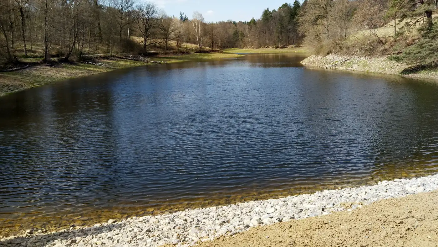
From here, we enter the Pfaffenwald forest, a serene woodland area with well-marked trails. Our path now leads us to the Bärensee (Bear Lake), nestled in a quiet valley surrounded by gentle hills and dense forest.Restaurant Bärenschlössle
Right by the lake lies the Bärenschlössle, a charming historic hunting lodge that today houses a café and restaurant. It’s an ideal spot for a scenic break.
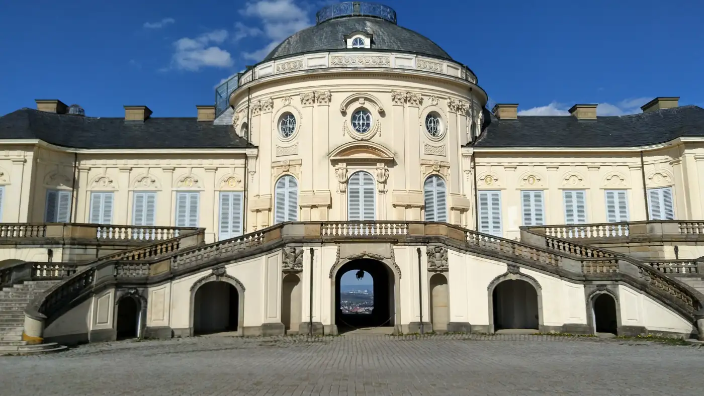
Solitude Palace
We continue our walk toward the iconic Solitude Palace, perched on a ridge with beautiful views over western Stuttgart and the surrounding countryside. This elegant Rococo palace was once a royal retreat and remains a gem of architecture and history.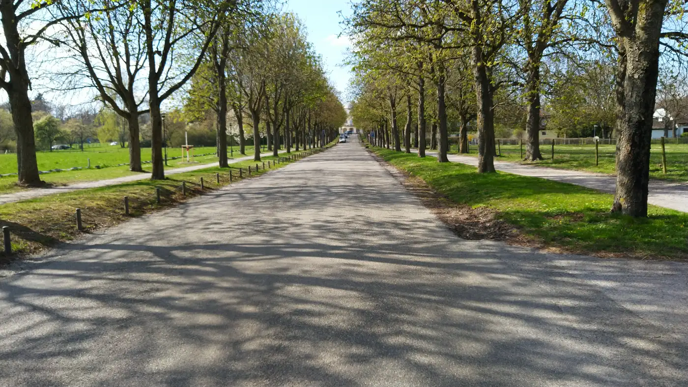
Duke Carl Eugen
Solitude Palace (Schloss Solitude) is one of the most elegant and iconic landmarks in the Stuttgart region. Built between 1764 and 1769 under Duke Carl Eugen of Württemberg, the palace was intended as a place of reflection, leisure, and prestige - a retreat from the formality of court life in Ludwigsburg.
Breathtaking Views over Swabia
Designed in the Rococo style, Solitude Palace is perched on a hill between Stuttgart and Leonberg, offering panoramic views over the surrounding forests, meadows, and villages. On clear days, visitors can even spot the Swabian Jura or the Black Forest on the horizon.
Solitud Central Building
The central building is gracefully symmetrical and features ornate interior halls, including the beautifully decorated White Hall. Surrounding it is a semi-circular colonnade and park area, which once formed part of a carefully planned ensemble including riding halls, servant quarters, and gardens.
Solitude-Allee
The palace is also the starting point of the "Solitude-Allee", a straight, historic avenue that once connected Solitude directly with Ludwigsburg Palace - a remarkable feat of landscape planning in the 18th century.Solitude Today
Today, Solitude is a favorite spot for hikers, photographers, and history lovers alike. It is also home to the Akademie Schloss Solitude, an international artist residency program that continues the site’s legacy as a place of creativity and inspiration.The trail descends toward Gerlingen, where the hike ends conveniently near a tram stop for an easy return.
Discover Solitude Palace - explore history, art, and breathtaking views in one unforgettable visit!
This tour was hiked, photographed, and described by a real person on 09.04.2025. The GPS data from the photos was recorded on-site and used to accurately reconstruct the route.
Tour profile
- ⛰️Easy hike
- 🧳Touristspot:⭐⭐⭐⭐
- 📏Distance: 11.61 km
- ⌚Walkingtime: 2h 47min
- 🚶Speed: 4.17 km/h
- ↗️Up: 277 m (ca)
- ↘️Down: 401 m (ca)
- ⬆️Highest Point: 556 m
- ⬇️Lowest Point: 331 m
- 🗺️Country: Germany
- 🌍Region: Stuttgart
- 👀Views: 94
- 📥
Getting There:
From Stuttgart Central Station (Hauptbahnhof) to Stuttgart-Vaihingen: There are direct S-Bahn connections from the main station to Vaihingen via lines S2 or S3. Travel time is approximately 14 minutes. Alternatively, you can take the U-Bahn line U14 from Staatsgalerie to Vaihingen. This route takes about 28 minutes.From Gerlingen back to the city center: The U-Bahn line U6 connects Gerlingen directly to Stuttgart Central Station (Arnulf-Klett-Platz). Travel time is approximately 35 to 38 minutes.
GPS-Wanderkarte ON+Offline
Interaktive Karte mit allen Wanderwegen, Sehenswürdigkeiten und wichtigen Standorten der Region. Die Karte ist zoombar, verschiebbar und enthält Marker mit weiteren Informationen zu den einzelnen Orten. Zudem kann sie mit dem GPS des Handys verbunden werden, um in Echtzeit anzuzeigen, an welcher Stelle des Wanderwegs man sich gerade befindet. Dies funktioniert auch Offline, wenn sich die Karte noch im Browsercache befindet.
Höhenprofil der Wanderung
Das interaktive Diagramm zeigt die Höhenmeter entlang des Wanderwegs. Durch Verschieben des blauen Pfeils wird die zugehörige Höhenlage auf der Karte über einen roten Pfeil angezeigt.